What is Cadastral Surveying and Boundary Settlement?
Boundary settlement is a complex process involving instrumental boundary surveying and office work to prepare the land boundary plan and other legal documents. We conduct a detailed evaluation of land cadastral data and compare it with the actual situation on the ground. During cadastral surveying, we use specific measurement equipment that ensures a high level of accuracy. The process includes several essential stages, starting from document analysis to physical boundary inspection works.
Latvian national regulatory acts set strict requirements for the land cadastral surveying process. Each land parcel must have precisely determined boundaries that correspond to both the documentation and the physical reality. The surveying process complies strictly with the Cabinet of Ministers Regulations Number 1019, “Land Cadastral Surveying Regulations”. SIA Palus provides technical measurements alongside consultations regarding land property settlement.
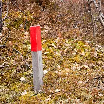
Refining land boundaries is essential before executing real estate transactions, starting construction, or implementing land management projects. Determining land unit boundaries involves establishing coordinate system ties and securing boundary points on the ground. We use various information sources to obtain data, including historical cadastral plans, orthophoto maps, and forest inventory materials.